Mondeluenghe
Aspetto
| Mondeluenghe comune tagliàne | |
|---|---|
 | |
| State | |
| Reggione | |
| Provinge | |
| Coordinate | 41°44′00″N 14°57′00″E |
| Altitudine | 592 m s.l.m. |
| Superficie | 12 km² |
| Crestiàne | 490 |
| Denzetà | 41 cr./km² |
| Comune 'nzeccate | Bonefro, Montorio nei Frentani, Rotello, Santa Croce di Magliano |
| CAP | 86040 |
| Prefisse | 0874 |
| Codece ISTAT | 070044 |
| Cod. catastale | F548 |
| Site istituzionale | |
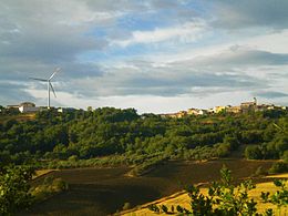
Mondeluenghe (in tagliàne Montelongo) éte 'nu comune tagliáne de 490 crestiáne.
Categorije:
- Stub
- Prefisso telefonico locale uguale a Wikidata
- Codice ISTAT uguale a Wikidata
- P18 lette da Uicchidate
- P281 uguale sus Uicchidate
- P806 uguale sus Uicchidate
- P856 uguale sus Uicchidate
- P2044 uguale sus Uicchidate
- P2046 differende sus Uicchidate
- Comune d'u Molise
- Comune d'a provinge de Cambevasce
- Pàggene cu le mappe

