
File:Danube at Budapest, Margit Bridge.jpg

Dimenziune de sta andeprime: 794 x 599 pixel. Otre resoluziune: 318 x 240 pixel • 636 x 480 pixel • 1 018 x 768 pixel • 1 280 x 966 pixel • 1 632 x 1 232 pixel.
File origgenale (1 632 × 1 232 pixel, dimenzione d'u fail: 583 KB, tipe de MIME: image/jpeg)
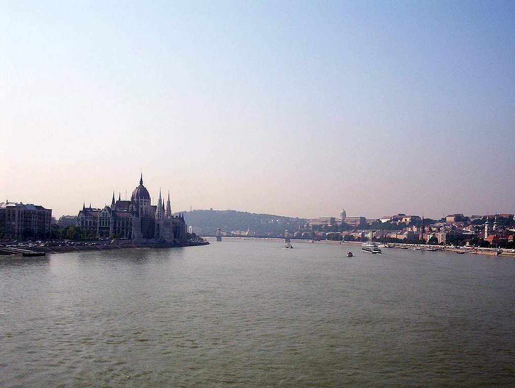
| Descrizione | Budapest with the Danube in foreground, looking south from Margit Bridge. |
| Date | 21 Lùglie 2004 09:25+02 (Europe/Budapest) |
| Sorgende | Fatije proprie |
| Autore | Gabor Eszes (UED77) |
| Permesse: (Ause stu file n'otra vote) |
Use it freely. |
| Luogo dello scatto | | Posizione di questa e altre immagini su: OpenStreetMap |
|---|
Ije, 'u titolare d'u copyright de sta fatìe, dichiare de pubblecarle sotte a le seguende licenze:

|
Permesse jè garandite pe copià, distribbuì e/o cangià stu documende sotte a le termine d'a Licenze GNU Free Documentation, Versione 1.2 o versione cchiù nuève pubblecate da Free Software Foundation; senze le Seziune Invariande, senze Front-Cover Texts, e senze Back-Cover Texts. 'Na copie d'a licenze jè ingluse jndr'à sezione titolate Licenze GNU Free Documentation. |
| Stu file jè licenziate sotte 'a Creatività comune Attribution-Share Alike 3.0 Unported licenze | ||
| ||
| Stu tag de licenze ha state aggiunde a stu file cumme parte de l'aggiornamende d'a licenze GFDL. |
Stu file jè licenziate sotte 'a licenze Creative Commons Attribution-Share Alike 2.5 Generiche, 2.0 Generiche, 2.0 Generiche e 1.0 Generiche
- Tu si libbere:
- da spartere – pe copià, distribbuì e trasmettere 'a fatìe
- da misckà – pe adattà a 'a fatìe
- Sotte a le condiziune seguende:
- attribbuzione – A dà le credite giuste, 'nu collegamende a 'a licenze e dicere ce onne state fatte de le cangiaminde. Puè farle accumme vuè tu, ma none jndr'à 'nu mode ca suggerisce ca 'u licenziande approve a te e l'ause tune.
- condivide cose simile – Ce tu cange, trasforme o costruisce sus a sta fatìe, tu puè destribbuì 'a fatìe ca ne iesse fore sule sotte a 'a stessa licenze o simile a queste.
Tu puè scacchià 'a licenze ca vuè.
|
cunde
Cazze sus 'na date/orarie pe vedè 'u fail a cumme asseva jndr'à quidde timbe.
| Sciurne/Orarie | Thumbnail | Dimenziune | Utende | Commende | |
|---|---|---|---|---|---|
| corrende | 16:00, 15 Lug 2016 | | 1 632 × 1 232 (583 KB) | Alonso de Mendoza | Color |
| 10:15, 1 Sce 2006 |  | 1 632 × 1 232 (147 KB) | UED77 | {{Information |Description =Budapest with the Danube in foreground, looking south from Margit Bridge. Taken from approximately 47°30′52.38″ N 19°02′38.63″ E, facing approximately 195°. |Source =Own work. |Date =2004-07-21 09:25+02 (Europe/Budap | |
| 17:25, 2 Abb 2005 |  | 796 × 601 (49 KB) | David.gaya | From English Wikipedia: Budapest with the Danube in foreground, looking south from Margit Bridge. Taken by UED77 in 2004 Summer. {{GFDL}} |
Ause d'u file
sta pàgene apponde a stu fail:
Ause d'u file globale
Le seguende Uicchi ausane stu file:
- Ause sus a am.wikipedia.org
- Ause sus a ar.wikipedia.org
- Ause sus a azb.wikipedia.org
- Ause sus a bat-smg.wikipedia.org
- Ause sus a ba.wikipedia.org
- Ause sus a co.wikipedia.org
- Ause sus a en.wiktionary.org
- Ause sus a gl.wikipedia.org
- Ause sus a got.wikipedia.org
- Ause sus a he.wikipedia.org
- Ause sus a hr.wikipedia.org
- Ause sus a id.wikipedia.org
- Ause sus a incubator.wikimedia.org
- Ause sus a it.wikipedia.org
- Ause sus a ja.wikipedia.org
- Ause sus a la.wikipedia.org
- Ause sus a mrj.wikipedia.org
- Ause sus a nah.wikipedia.org
- Ause sus a ne.wikipedia.org
- Ause sus a nn.wikipedia.org
- Ause sus a oc.wikipedia.org
- Ause sus a pl.wikipedia.org
- Ause sus a pl.wiktionary.org
- Ause sus a pms.wikipedia.org
- Ause sus a ru.wikipedia.org
- Ause sus a sc.wikipedia.org
- Ause sus a sv.wikipedia.org
- Donau
- Användare:Thoasp
- Användardiskussion:Twincinema
- Användardiskussion:Kr-val/Arkiv 2008
- Användare:Kr-val
- Användare:Calandrella
- Användardiskussion:Orvarmanne
- Användare:Hobe
- Användare:Calandrella/Utmärkelser
- Wikipedia:Geografisamarbetet
- Mall:Veckans geograf
- Användardiskussion:Hwerik
- Användardiskussion:Svanen93
Vide ause globale de stu file.