
File:Usa edcp relief location map.png

Dimenziune de sta andeprime: 800 x 495 pixel. Otre resoluziune: 320 x 198 pixel • 640 x 396 pixel • 1 181 x 731 pixel.
File origgenale (1 181 × 731 pixel, dimenzione d'u fail: 1,56 MB, tipe de MIME: image/png)
Riepileghe
| Descrizione |
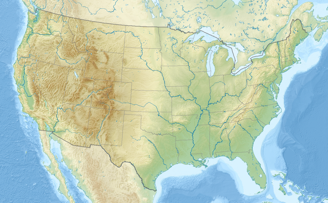
English: Relief location map of the USA (without Hawaii and Alaska).
EquiDistantConicProjection : Central parallel : * N: 37.0° N Central meridian : * E: 96.0° W Standard parallels: * 1: 32.0° N * 2: 42.0° N Made with Natural Earth. Free vector and raster map data @ naturalearthdata.com. Formulas for x and y: x = 50.0 + 124.03149777329222 * ((1.9694462586094064-({{{2}}}* pi / 180))
* sin(0.6010514667026994 * ({{{3}}} + 96) * pi / 180))
y = 50.0 + 1.6155950752393982 * 124.03149777329222 * 0.02613325650382181
- 1.6155950752393982 * 124.03149777329222 *
(1.3236744353715044 - (1.9694462586094064-({{{2}}}* pi / 180))
* cos(0.6010514667026994 * ({{{3}}} + 96) * pi / 180))
|
| Date | |
| Sorgende | Fatije proprie |
| Autore | Uwe Dedering |
| Otre versiune |
|

Licenziate da
Ije, 'u titolare d'u copyright de sta fatìe, dichiare de pubblecarle sotte a le seguende licenze:
Stu file jè licenziate sotte 'a Creatività comune Attribution-Share Alike 3.0 Unported licenze
- Tu si libbere:
- da spartere – pe copià, distribbuì e trasmettere 'a fatìe
- da misckà – pe adattà a 'a fatìe
- Sotte a le condiziune seguende:
- attribbuzione – A dà le credite giuste, 'nu collegamende a 'a licenze e dicere ce onne state fatte de le cangiaminde. Puè farle accumme vuè tu, ma none jndr'à 'nu mode ca suggerisce ca 'u licenziande approve a te e l'ause tune.
- condivide cose simile – Ce tu cange, trasforme o costruisce sus a sta fatìe, tu puè destribbuì 'a fatìe ca ne iesse fore sule sotte a 'a stessa licenze o simile a queste.

|
Permesse jè garandite pe copià, distribbuì e/o cangià stu documende sotte a le termine d'a Licenze GNU Free Documentation, Versione 1.2 o versione cchiù nuève pubblecate da Free Software Foundation; senze le Seziune Invariande, senze Front-Cover Texts, e senze Back-Cover Texts. 'Na copie d'a licenze jè ingluse jndr'à sezione titolate Licenze GNU Free Documentation. |
Tu puè scacchià 'a licenze ca vuè.
cunde
Cazze sus 'na date/orarie pe vedè 'u fail a cumme asseva jndr'à quidde timbe.
| Sciurne/Orarie | Thumbnail | Dimenziune | Utende | Commende | |
|---|---|---|---|---|---|
| corrende | 22:50, 2 Abb 2024 | | 1 181 × 731 (1,56 MB) | Spesh531 | correction to Rhode Island border. Little Compton and Tiverton was previously shown to be in Massachusetts |
| 18:32, 23 Dec 2016 |  | 1 181 × 731 (1,47 MB) | Jeanjung212 | Lossless Compressed/optimized png decreasing file size by 193731 bytes | |
| 12:37, 24 Agú 2010 |  | 1 181 × 731 (1,66 MB) | Uwe Dedering | {{Information |Description={{en|1=Relief location map of the USA (without Hawaii and Alaska). EquiDistantConicProjection : Central parallel : * N: 37.0° N Central meridian : * E: 96.0° W Standard parallels: * 1: 32.0° N * 2: 42.0° N Made with Nat |
Ause d'u file
sta pàgene apponde a stu fail:
Ause d'u file globale
Le seguende Uicchi ausane stu file:
- Ause sus a ab.wikipedia.org
- Ause sus a ace.wikipedia.org
- Ause sus a als.wikipedia.org
- Ause sus a ang.wikipedia.org
- Ause sus a ar.wikipedia.org
- قالب:خريطة مواقع
- قالب:خريطة مواقع/شرح
- قالب:خريطة مواقع الولايات المتحدة
- قالب:خريطة مواقع الولايات المتحدة2
- قالب:خريطة مواقع/ملعب
- وحدة:Location map/data/USA
- وحدة:Location map/data/United States
- وحدة:Location map/data/USA/شرح
- وحدة:Location map/data/United States of America
- كلية مونماوث
- وحدة:Location map/data/United States/شرح
- وحدة:Location map/data/United States of America/شرح
- بوينغ فيلد
- جامعات أمريكية حسب عدد الملتحقين بالمرحلة الجامعية
- جامعات الولايات المتحدة حسب عدد المسجلين
- فورتشن 1000
- تكوين هيل كريك
- انفجار صاروخ تيتان في داماسكيوس 1980
- تحطم طائرة بوينغ بي-52 في قاعدة فيرتشايلد الجوية
- Ause sus a arz.wikipedia.org
- Ause sus a ast.wikipedia.org
- Ause sus a as.wikipedia.org
- Ause sus a av.wikipedia.org
- Ause sus a azb.wikipedia.org
Vide ause globale de stu file.