
File:Italy topographic map-blank.svg

Dimenzione de quiste PNG andeprime de quiste SVG file: 487 x 600 pixel. Otre resoluziune: 195 x 240 pixel • 390 x 480 pixel • 623 x 768 pixel • 831 x 1 024 pixel • 1 662 x 2 048 pixel • 1 759 x 2 167 pixel.
File origgenale (Fail SVG, nominalmende sonde 1 759 × 2 167 pixel, dimenzione d'u fail: 1,98 MB)

Riepileghe
| Descrizione |
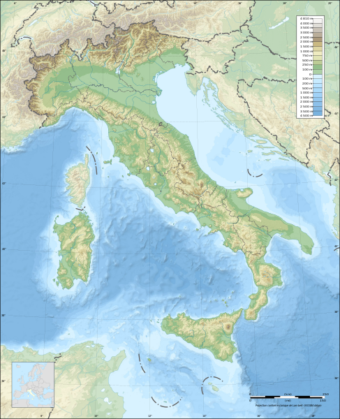
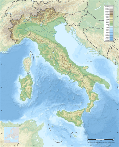
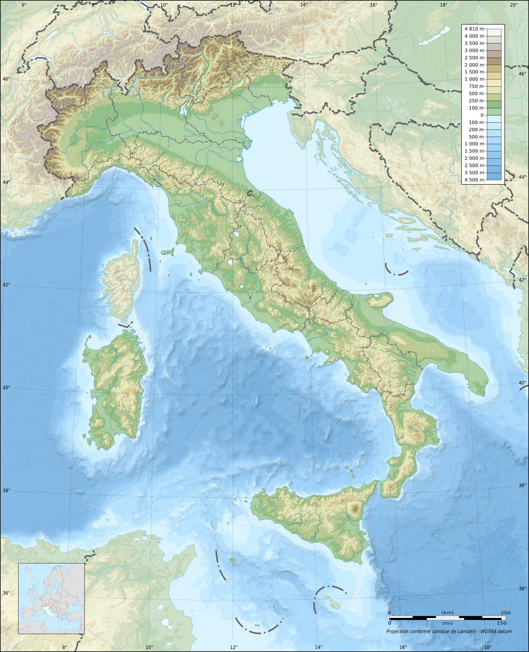
English: Blank topographic map of Italy, with regions boundaries and including the 08-2009 modification of the boundary between Emilia-Romagna and Marches regions.
Note: The background map is a raster image embedded in the SVG file. Français : Carte topographique vierge de l'Italie, avec limites des régions et intégrant la modification d'août 2009 de la frontière entre les régions Emilia-Romagna et Marches.
Note : Le fond de carte est une image bitmap embarquée dans le fichier SVG. Deutsch: Topografische Karte Italiens, mit den Grenzen der Regionen (einschließlich der Änderungen im August 2009 zwischen den Regionen Emilia-Romagna und Marken) ohne Beschriftung. Hinweis: Der Hintergrund ist ein Rasterbild, eingebettet in die SVG-Datei. Lambert conformal conic projection; WGS84 datum
|
| Date | |
| Sorgende |
Fatije proprie
|
| Autore | Eric Gaba (Sting - fr:Sting) |
| Permesse: (Ause stu file n'otra vote) |
Stu file jè licenziate sotte 'a Creatività comune Attribution-Share Alike 3.0 Unported licenze
|
| Otre versiune |
Derivative works of this file:
|

| Attribution and Share-Alike required |
|---|
| Any use of this map can be made as long as you credit me (Eric Gaba – Wikimedia Commons user: Sting) as the author, User:NordNordWest for the regions boundaries, and distribute the copies and derivative works under the same license(s) that the one(s) stated below. A message with a reply address would also be greatly appreciated. |
| Luogo dello scatto | | Posizione di questa e altre immagini su: OpenStreetMap |
|---|
Licenziate da
Ije, 'u titolare d'u copyright de sta fatìe, dichiare de pubblecarle sotte a le seguende licenze:

|
Permesse jè garandite pe copià, distribbuì e/o cangià stu documende sotte a le termine d'a Licenze GNU Free Documentation, Versione 1.2 o versione cchiù nuève pubblecate da Free Software Foundation; senze le Seziune Invariande, senze Front-Cover Texts, e senze Back-Cover Texts. 'Na copie d'a licenze jè ingluse jndr'à sezione titolate Licenze GNU Free Documentation. |
Stu file jè licenziate sotte 'a Creatività comune Attribution-Share Alike 3.0 Unported licenze
- Tu si libbere:
- da spartere – pe copià, distribbuì e trasmettere 'a fatìe
- da misckà – pe adattà a 'a fatìe
- Sotte a le condiziune seguende:
- attribbuzione – A dà le credite giuste, 'nu collegamende a 'a licenze e dicere ce onne state fatte de le cangiaminde. Puè farle accumme vuè tu, ma none jndr'à 'nu mode ca suggerisce ca 'u licenziande approve a te e l'ause tune.
- condivide cose simile – Ce tu cange, trasforme o costruisce sus a sta fatìe, tu puè destribbuì 'a fatìe ca ne iesse fore sule sotte a 'a stessa licenze o simile a queste.
Tu puè scacchià 'a licenze ca vuè.
cunde
Cazze sus 'na date/orarie pe vedè 'u fail a cumme asseva jndr'à quidde timbe.
| Sciurne/Orarie | Thumbnail | Dimenziune | Utende | Commende | |
|---|---|---|---|---|---|
| corrende | 23:13, 17 Lug 2010 | | 1 759 × 2 167 (1,98 MB) | Sting | Oups! Not the correct background |
| 23:05, 17 Lug 2010 |  | 1 759 × 2 167 (2,17 MB) | Sting | Color profile: better unsaturated colors than over-saturated ones in non color managed browsers | |
| 16:16, 14 Set 2009 |  | 1 759 × 2 167 (1,96 MB) | Sting | updating borders after important variation (http://www.gazzettaufficiale.it/guridb/dispatcher?service=1&datagu=2009-08-14&task=dettaglio&numgu=188&redaz=009G0127&tmstp=1250276942469) - cf File:Italy_location_map.svg ; + several other improvements | |
| 06:07, 26 Abb 2009 |  | 1 759 × 2 167 (1,77 MB) | Sting | == Summary == {{Location|42|00|00|N|12|00|00|E|scale:5000000}} <br/> {{Information |Description={{en|Blank topographic map of Italy, with regions boundaries.<br/>''Note:'' The background map is a raster image embedded in the SVG file.}} {{fr |
Ause d'u file
2 ste pàggene appondene a stu fail:
Ause d'u file globale
Le seguende Uicchi ausane stu file:
- Ause sus a ar.wikipedia.org
- Ause sus a ast.wikipedia.org
- Ause sus a azb.wikipedia.org
- بولونیا
- اسکافاتی
- سیراکوز
- مونتزا
- جیوگلیانو
- لاتینا
- ساساری
- فرارا
- سالرنو
- ریمینی
- فوجا
- لیورنو
- راونا
- پروجا
- رجیو نل امیلیا
- رجیو کالابریا
- پراتو
- پارما
- برشا
- تریسته
- پادووا
- مسینا
- ونیز
- کاتانیا
- باری
- فلورانس
- جینووا
- تورین
- ناپول
- پوتزولی
- سستو سان جووانی
- گروستو
- مارسالا
- بوستو آرسیتسیو
- ترویزو
- کومو
- توره دل گرکو
- بریندیزی
- لوکا
- گیدونیا مونتچلیو
- کاتانزارو
- لا اسپتزیا
- آلساندریا
- پزارو
- بارلتا
- لچه
- چزنا
Vide ause globale de stu file.