
File:Denmark location map.svg

Dimenzione de quiste PNG andeprime de quiste SVG file: 703 x 600 pixel. Otre resoluziune: 281 x 240 pixel • 563 x 480 pixel • 900 x 768 pixel • 1 201 x 1 024 pixel • 2 401 x 2 048 pixel • 1 836 x 1 566 pixel.
File origgenale (Fail SVG, nominalmende sonde 1 836 × 1 566 pixel, dimenzione d'u fail: 435 KB)
Riepileghe
| Descrizione |
Deutsch: Positionskarte von Dänemark
Quadratische Plattkarte, N-S-Streckung 180 %. Geographische Begrenzung der Karte:
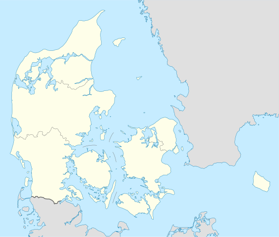
English: Location map of Denmark
Equirectangular projection, N/S stretching 180 %. Geographic limits of the map:
|
||
| Date | |||
| Sorgende | Fatije proprie, using United States National Imagery and Mapping Agency data | ||
| Autore | NordNordWest | ||
| Otre versiune | Derivative works of this file: Regenbogen location map.svg | ||
| SVG sviluppo | Questa mappa in grafica vettoriale è stata creata con Inkscape, o con qualche altro programma.
|

Licenziate da
Ije, 'u titolare d'u copyright de sta fatìe, dichiare de pubblecarle sotte a le seguende licenze:

|
Permesse jè garandite pe copià, distribbuì e/o cangià stu documende sotte a le termine d'a Licenze GNU Free Documentation, Versione 1.2 o versione cchiù nuève pubblecate da Free Software Foundation; senze le Seziune Invariande, senze Front-Cover Texts, e senze Back-Cover Texts. 'Na copie d'a licenze jè ingluse jndr'à sezione titolate Licenze GNU Free Documentation. |
Stu file jè licenziate sotte 'a Creatività comune Attribution-Share Alike 3.0 Unported licenze
- Tu si libbere:
- da spartere – pe copià, distribbuì e trasmettere 'a fatìe
- da misckà – pe adattà a 'a fatìe
- Sotte a le condiziune seguende:
- attribbuzione – A dà le credite giuste, 'nu collegamende a 'a licenze e dicere ce onne state fatte de le cangiaminde. Puè farle accumme vuè tu, ma none jndr'à 'nu mode ca suggerisce ca 'u licenziande approve a te e l'ause tune.
- condivide cose simile – Ce tu cange, trasforme o costruisce sus a sta fatìe, tu puè destribbuì 'a fatìe ca ne iesse fore sule sotte a 'a stessa licenze o simile a queste.
Tu puè scacchià 'a licenze ca vuè.
cunde
Cazze sus 'na date/orarie pe vedè 'u fail a cumme asseva jndr'à quidde timbe.
| Sciurne/Orarie | Thumbnail | Dimenziune | Utende | Commende | |
|---|---|---|---|---|---|
| corrende | 17:30, 25 Nov 2022 | | 1 836 × 1 566 (435 KB) | GrandEscogriffe | more correct north-south stretching |
| 20:57, 25 Agú 2008 |  | 1 836 × 1 479 (441 KB) | NordNordWest | size correction | |
| 10:53, 2 Lug 2008 |  | 612 × 493 (434 KB) | NordNordWest | {{Information |Description= {{de|Positionskarte von Dänemark}} Quadratische Plattkarte, N-S-Streckung 170 %. Geographische Begrenzung der Karte: * N: 57.9° N * S: 54.3° N * W: 8.8° O * O: 15.4° O {{en|Location map of [[:en:Denmark|D |
Ause d'u file
sta pàgene apponde a stu fail:
Ause d'u file globale
Le seguende Uicchi ausane stu file:
- Ause sus a af.wikipedia.org
- Ause sus a ar.wikipedia.org
- Ause sus a az.wikipedia.org
- Ause sus a ba.wikipedia.org
- Ause sus a be-tarask.wikipedia.org
- Капэнгаген
- Гэрнінг
- Шаблён:Лякалізацыйная мапа Даніі
- Одэнсэ
- Лянгелян
- Фальстэр
- Стрэймай
- Сувурай
- Фуглёй
- Эстурой
- Сандой
- Кальсой
- Скувой
- Вагар
- Наўльсой
- Люйтля-Дуймун
- Віёй
- Свуйной
- Скаген
- Оргус
- Чэмпіянат Эўропы па гандболе сярод мужчынаў 2014 году
- Брэнбю
- Ольбарг
- Ранэрс
- Эсб’ерг
- Кольдынг
- Горсэнс
- Вайле
- Роскіле
- Гэльсынгёр
- Сылькебарг
- Нэствэд
- Фрэдэрысія
Vide ause globale de stu file.