
File:Yellowrivermap.jpg
Dimenziune de sta andeprime: 800 x 503 pixel. Otre resoluziune: 320 x 201 pixel • 640 x 403 pixel • 1 024 x 644 pixel • 1 280 x 805 pixel • 2 497 x 1 571 pixel.
File origgenale (2 497 × 1 571 pixel, dimenzione d'u fail: 1,19 MB, tipe de MIME: image/jpeg)
Riepileghe
| Descrizione |
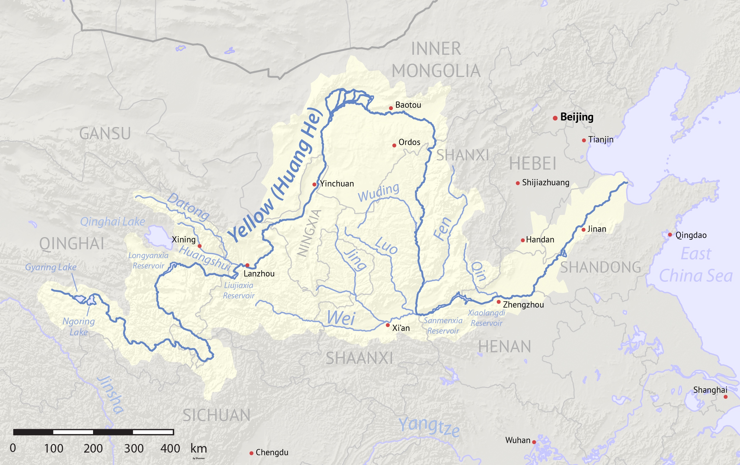
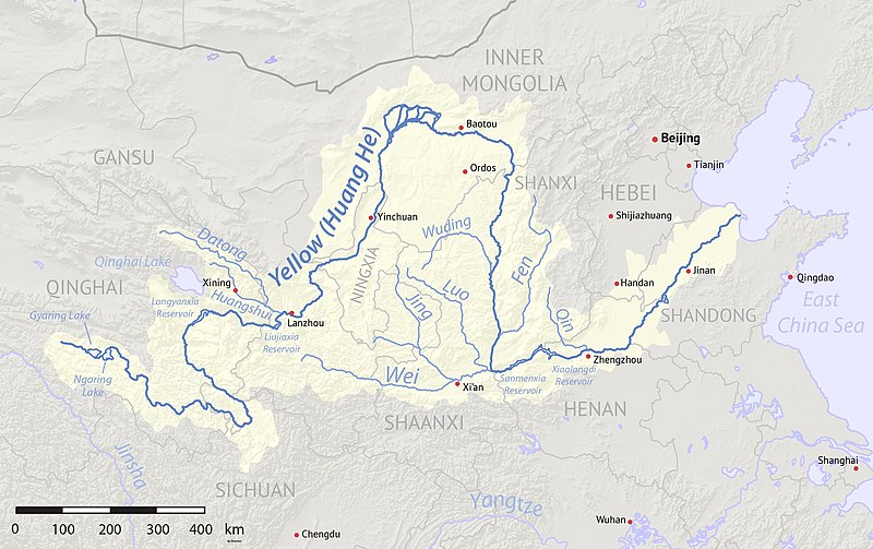
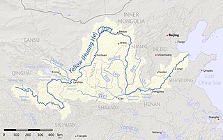
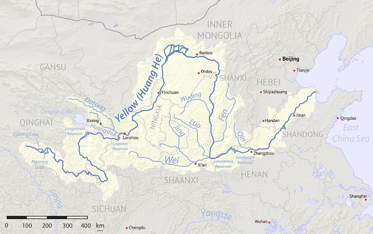
English: Map of the Yellow River, whose watershed covers most of northern China and drains to the Yellow Sea |
| Date | (2017-08-10 revised) |
| Sorgende | Created using Natural Earth and NASA SRTM data, both public domain. |
| Autore | Shannon1 |
| Otre versiune |
Derivative works of this file: |
Licenziate da
Ije, 'u titolare d'u copyright de sta fatìe, dichiare de pubblecarle sotte a le seguende licenze:

|
Permesse jè garandite pe copià, distribbuì e/o cangià stu documende sotte a le termine d'a Licenze GNU Free Documentation, Versione 1.2 o versione cchiù nuève pubblecate da Free Software Foundation; senze le Seziune Invariande, senze Front-Cover Texts, e senze Back-Cover Texts. 'Na copie d'a licenze jè ingluse jndr'à sezione titolate Licenze GNU Free Documentation. |
Questo file è licenziato in base ai termini delle licenze Creative Commons Attribuzione-Condividi allo stesso modo 4.0 Internazionale, 3.0 Unported, 2.5 Generico, 2.0 Generico e 1.0 Generico
- Tu si libbere:
- da spartere – pe copià, distribbuì e trasmettere 'a fatìe
- da misckà – pe adattà a 'a fatìe
- Sotte a le condiziune seguende:
- attribbuzione – A dà le credite giuste, 'nu collegamende a 'a licenze e dicere ce onne state fatte de le cangiaminde. Puè farle accumme vuè tu, ma none jndr'à 'nu mode ca suggerisce ca 'u licenziande approve a te e l'ause tune.
- condivide cose simile – Ce tu cange, trasforme o costruisce sus a sta fatìe, tu puè destribbuì 'a fatìe ca ne iesse fore sule sotte a 'a stessa licenze o simile a queste.
Tu puè scacchià 'a licenze ca vuè.
cunde
Cazze sus 'na date/orarie pe vedè 'u fail a cumme asseva jndr'à quidde timbe.
| Sciurne/Orarie | Thumbnail | Dimenziune | Utende | Commende | |
|---|---|---|---|---|---|
| corrende | 06:17, 11 Agú 2017 | | 2 497 × 1 571 (1,19 MB) | Shannon1 | Uploaded clearer version with corrected data. |
| 04:23, 2 Mar 2010 |  | 1 100 × 544 (401 KB) | Shannon1 | {{Information |Description={{en|1=Map of the Yellow River, whose watershed covers most of northern China and drains to the Bohai Sea}} |Source=Background and river course data from http://www2.demis.nl/mapserver/mapper.asp |Author=[[User:Shannonchan|Shan |
Ause d'u file
sta pàgene apponde a stu fail:
Ause d'u file globale
Le seguende Uicchi ausane stu file:
- Ause sus a af.wikipedia.org
- Ause sus a als.wikipedia.org
- Ause sus a an.wikipedia.org
- Ause sus a ary.wikipedia.org
- Ause sus a ast.wikipedia.org
- Ause sus a as.wikipedia.org
- Ause sus a azb.wikipedia.org
- Ause sus a ba.wikipedia.org
- Ause sus a bcl.wikipedia.org
- Ause sus a be-tarask.wikipedia.org
- Ause sus a bg.wikipedia.org
- Ause sus a bh.wikipedia.org
- Ause sus a bn.wikipedia.org
- Ause sus a bo.wikipedia.org
- Ause sus a br.wikipedia.org
- Ause sus a bs.wikipedia.org
- Ause sus a bxr.wikipedia.org
- Ause sus a ca.wikipedia.org
- Ause sus a ceb.wikipedia.org
- Ause sus a cs.wikipedia.org
- Ause sus a de.wikipedia.org
- Ause sus a diq.wikipedia.org
- Ause sus a en.wikipedia.org
- Ause sus a en.wikivoyage.org
- Ause sus a eo.wikipedia.org
- Ause sus a es.wikipedia.org
Vide ause globale de stu file.