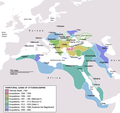
File:OttomanEmpireIn1683.png

Dimenziune de sta andeprime: 637 x 599 pixel. Otre resoluziune: 255 x 240 pixel • 510 x 480 pixel • 816 x 768 pixel • 1 088 x 1 024 pixel • 1 966 x 1 850 pixel.
File origgenale (1 966 × 1 850 pixel, dimenzione d'u fail: 298 KB, tipe de MIME: image/png)
cunde
Cazze sus 'na date/orarie pe vedè 'u fail a cumme asseva jndr'à quidde timbe.
| Sciurne/Orarie | Thumbnail | Dimenziune | Utende | Commende | |
|---|---|---|---|---|---|
| corrende | 19:35, 17 Set 2020 |  | 1 966 × 1 850 (298 KB) | Visnelma | Adjusted eastern and balkan borders, also vassals are added. |
| 00:36, 17 Set 2020 |  | 1 966 × 1 850 (296 KB) | Visnelma | African coast of Red Sea was painted purple by mistake, I have corrected that. Also Georgia was an Ottoman vassal. I have added that. | |
| 23:42, 16 Set 2020 |  | 1 966 × 1 850 (296 KB) | Visnelma | Athens and Morea was conquered during the reign of Mehmed II. Odessa and Moldova was conquered during the reign of Beyazid II. Hicaz and Yemen was conquered by Selim I. The region that connected Ottoman mainland and Crimea was conquered during the reign of Suleiman the Magnificent as well as Georgia. The territory on Persian gulf which is extension of Iraq was conquered during the reign of Suleiman, Ottomans never conquered Circassia. Furthermore Podolia was conquered during the 17th century,... | |
| 19:49, 31 Màs 2014 |  | 1 966 × 1 850 (369 KB) | Spiridon Ion Cepleanu | New rectification since H.-E. Stier (dir.): « Westermann Grosser Atlas zur Weltgeschichte », 1985, ISBN 3-14-100919-8, pp. 96, 97, 103, 112 (because the accuracy is disputed) but with a better appearence I hope. | |
| 19:58, 6 Mar 2013 |  | 1 966 × 1 850 (339 KB) | DragonTiger23 | Reverted to version as of 23:11, 10 December 2010 Returned the map to its original appearance. | |
| 21:47, 4 Mar 2012 |  | 637 × 599 (172 KB) | Spiridon Ion Cepleanu | Little changes since Hans-Erich Stier (ed.), Grosser Atlas zur Weltgeschichte, Westermann 1895, ISBN 3-14-10 0919-8, pp. 103, 103 & 112. | |
| 01:11, 11 Dec 2010 |  | 1 966 × 1 850 (339 KB) | Lambiam | Scale indicator more up to actual scale | |
| 20:53, 16 Nov 2010 |  | 1 966 × 1 850 (367 KB) | Hamelin de Guettelet | {{Information |Description= Rhodes et autres îles ne sont prises aux Hospitaliers que le 1 janvier 1523 |Source={{own}} |Date=16 novembre 2010 |Author=Hamelin de Guettelet |Permission= |other_versions= }} | |
| 12:40, 1 Abb 2010 |  | 1 966 × 1 850 (327 KB) | Nedim Ardoğa | Reverted to version as of 07:37, 10 March 2010 | |
| 14:11, 31 Mar 2010 |  | 637 × 599 (165 KB) | Bahramm 2 | Reverted to version as of 14:12, 1 March 2010 |
Ause d'u file
sta pàgene apponde a stu fail:
Ause d'u file globale
Le seguende Uicchi ausane stu file:
- Ause sus a af.wikipedia.org
- Ause sus a am.wikipedia.org
- Ause sus a ar.wikipedia.org
- Ause sus a ast.wikipedia.org
- Ause sus a av.wikipedia.org
- Ause sus a az.wikipedia.org
- Ause sus a ba.wikipedia.org
- Ause sus a be.wikipedia.org
- Ause sus a bg.wikipedia.org
- Ause sus a bn.wikipedia.org
- Ause sus a bs.wikipedia.org
- Ause sus a bxr.wikipedia.org
- Ause sus a ca.wikipedia.org
- Ause sus a cdo.wikipedia.org
- Ause sus a ce.wikipedia.org
- Ause sus a ckb.wikipedia.org
Vide ause globale de stu file.


