
File:Moscow satellite image.jpeg
Dimenziune de sta andeprime: 600 x 600 pixel. Otre resoluziune: 240 x 240 pixel • 480 x 480 pixel • 1 000 x 1 000 pixel.
File origgenale (1 000 × 1 000 pixel, dimenzione d'u fail: 396 KB, tipe de MIME: image/jpeg)
Riepileghe
| Descrizione |
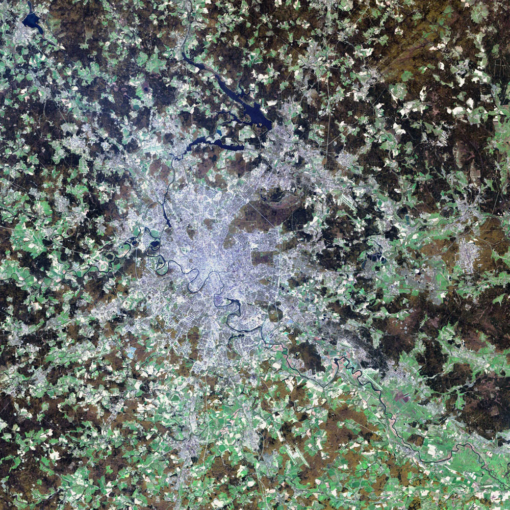
Deutsch: Satellitenbild von de:Moskau English: satellite image of the city of en:Moscow.
|
| Date | 2 Agúste 2002 |
| Sorgende | NASA Visible Earth project, http://visibleearth.nasa.gov/view_rec.php?id=3434 |
| Autore | NASA/USGS EROS Data Center Satellite Systems Branch/Landsat 7/ETM+ |
Licenziate da
Quest'immagine è nel pubblico dominio perché contiene materiale proveniente dallo United States Geological Survey, un'agenzia del Dipartimento degli Interni degli Stati Uniti. Per maggiori informazioni vedere la politica ufficiale dell'USGS sul copyright.
|
| Questo file è nel pubblico dominio perché creato dalla NASA. La politica sul copyright della NASA afferma che «il materiale della NASA non è protetto da copyright a meno che non sia specificato altrimenti». (NASA copyright policy e JPL Image Use Policy). | ||
 |
Attenzione:
|
cunde
Cazze sus 'na date/orarie pe vedè 'u fail a cumme asseva jndr'à quidde timbe.
| Sciurne/Orarie | Thumbnail | Dimenziune | Utende | Commende | |
|---|---|---|---|---|---|
| corrende | 07:12, 8 Nov 2004 | | 1 000 × 1 000 (396 KB) | Ævar Arnfjörð Bjarmason |
Ause d'u file
sta pàgene apponde a stu fail:
Ause d'u file globale
Le seguende Uicchi ausane stu file:
- Ause sus a af.wikipedia.org
- Ause sus a ar.wikipedia.org
- Ause sus a be-tarask.wikipedia.org
- Ause sus a ca.wikipedia.org
- Ause sus a hif.wikipedia.org
- Ause sus a hr.wikipedia.org
- Ause sus a hu.wiktionary.org
- Ause sus a it.wikipedia.org
- Ause sus a kk.wikipedia.org
- Ause sus a lb.wikipedia.org
- Ause sus a my.wikipedia.org
- Ause sus a ru.wikipedia.org
- Ause sus a sh.wikipedia.org
- Ause sus a sl.wikipedia.org
- Ause sus a yi.wikipedia.org