
File:Iran location map.svg

Dimenzione de quiste PNG andeprime de quiste SVG file: 672 x 600 pixel. Otre resoluziune: 269 x 240 pixel • 538 x 480 pixel • 861 x 768 pixel • 1 147 x 1 024 pixel • 2 295 x 2 048 pixel • 1 200 x 1 071 pixel.
File origgenale (Fail SVG, nominalmende sonde 1 200 × 1 071 pixel, dimenzione d'u fail: 299 KB)
Riepileghe
| Descrizione |
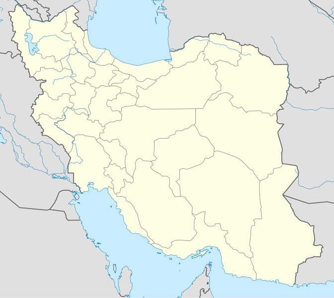
English: Location map of Iran.
Equirectangular projection. Stretched by 118.0%. Geographic limits of the map: * N: 40.0° N * S: 24.5° N * W: 43.5° E * E: 64.0° EMade with Natural Earth. Free vector and raster map data @ naturalearthdata.com. |
| Date | |
| Sorgende | Fatije proprie |
| Autore | Uwe Dedering |
| Otre versiune |
Opere derivate da questo file:
|
| SVG sviluppo | Il codice sorgente di questo file SVG non è valido a causa di 1 errore. Questa mappa in grafica vettoriale non valida secondo il W3C è stata creata con Adobe Illustrator, e con Inkscape. |

Licenziate da
Ije, 'u titolare d'u copyright de sta fatìe, dichiare de pubblecarle sotte a le seguende licenze:
Stu file jè licenziate sotte 'a Creatività comune Attribution-Share Alike 3.0 Unported licenze
- Tu si libbere:
- da spartere – pe copià, distribbuì e trasmettere 'a fatìe
- da misckà – pe adattà a 'a fatìe
- Sotte a le condiziune seguende:
- attribbuzione – A dà le credite giuste, 'nu collegamende a 'a licenze e dicere ce onne state fatte de le cangiaminde. Puè farle accumme vuè tu, ma none jndr'à 'nu mode ca suggerisce ca 'u licenziande approve a te e l'ause tune.
- condivide cose simile – Ce tu cange, trasforme o costruisce sus a sta fatìe, tu puè destribbuì 'a fatìe ca ne iesse fore sule sotte a 'a stessa licenze o simile a queste.

|
Permesse jè garandite pe copià, distribbuì e/o cangià stu documende sotte a le termine d'a Licenze GNU Free Documentation, Versione 1.2 o versione cchiù nuève pubblecate da Free Software Foundation; senze le Seziune Invariande, senze Front-Cover Texts, e senze Back-Cover Texts. 'Na copie d'a licenze jè ingluse jndr'à sezione titolate Licenze GNU Free Documentation. |
Tu puè scacchià 'a licenze ca vuè.
cunde
Cazze sus 'na date/orarie pe vedè 'u fail a cumme asseva jndr'à quidde timbe.
| Sciurne/Orarie | Thumbnail | Dimenziune | Utende | Commende | |
|---|---|---|---|---|---|
| corrende | 09:59, 22 Ott 2013 | | 1 200 × 1 071 (299 KB) | NordNordWest | Reverted to version as of 17:55, 15 April 2013; no reason for change given |
| 15:44, 21 Ott 2013 |  | 1 200 × 1 071 (640 KB) | Ekivalan | Reverted to version as of 17:38, 12 April 2013 | |
| 15:43, 21 Ott 2013 |  | 1 200 × 1 071 (640 KB) | Ekivalan | Reverted to version as of 17:38, 12 April 2013 | |
| 19:55, 15 Abb 2013 |  | 1 200 × 1 071 (299 KB) | NordNordWest | according to http://images.persianblog.ir/516041_B0b76ypr.jpg + Tabas -> South Khorasan province | |
| 19:40, 12 Abb 2013 |  | 1 200 × 1 071 (640 KB) | Yamaha5 | Reverted to version as of 20:08, 11 July 2010 | |
| 19:38, 12 Abb 2013 |  | 1 200 × 1 071 (640 KB) | Yamaha5 | Reverted to version as of 20:08, 11 July 2010 in all maps khorasan is like past! | |
| 13:30, 17 Mar 2013 |  | 1 200 × 1 071 (294 KB) | NordNordWest | upd | |
| 22:08, 11 Lug 2010 |  | 1 200 × 1 071 (640 KB) | Uwe Dedering | 31. province Alborz | |
| 19:44, 18 Feb 2010 |  | 1 200 × 1 071 (705 KB) | Uwe Dedering | Bahrain above water, no disputed countries | |
| 15:00, 18 Feb 2010 |  | 1 200 × 1 071 (709 KB) | Uwe Dedering | {{Information |Description={{en|1=Location map of Iran. Equirectangular projection. Strechted by 118.0%. Geographic limits of the map: * N: 40.0° N * S: 24.5° N * W: 43.5° E * E: 64.0° E Made with Natural Earth. Free vector and raster map data @ |
Ause d'u file
2 ste pàggene appondene a stu fail:
Ause d'u file globale
Le seguende Uicchi ausane stu file:
- Ause sus a af.wikipedia.org
- Ause sus a als.wikipedia.org
- Ause sus a an.wikipedia.org
- Ause sus a ar.wikipedia.org
- محمد بن إسماعيل البخاري
- طهران
- صحيح مسلم
- محافظات إيران
- فخر الدين الرازي
- كأس آسيا 1968
- كأس آسيا 1976
- مسلم بن الحجاج
- قالب:خريطة مواقع إیران
- مشهد
- زلزال بم 2003
- تفجيرات زاهدان 2010
- زلزال طبس 1978
- بطولة آسيا للناشئين تحت 16 عاما 2012
- قائمة المفكرين المسيحيين في العلم
- مرتضى الأنصاري
- زلزال تبريز 2012
- شعيطة (رامشير)
Vide ause globale de stu file.