
File:Greater London UK locator map 2010.svg

Dimenzione de quiste PNG andeprime de quiste SVG file: 494 x 600 pixel. Otre resoluziune: 198 x 240 pixel • 395 x 480 pixel • 633 x 768 pixel • 843 x 1 024 pixel • 1 687 x 2 048 pixel • 1 108 x 1 345 pixel.
File origgenale (Fail SVG, nominalmende sonde 1 108 × 1 345 pixel, dimenzione d'u fail: 302 KB)
Riepileghe
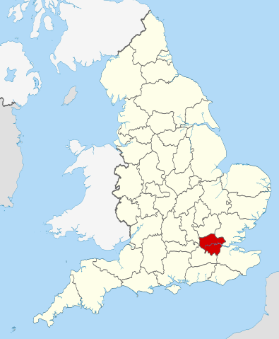
| Descrizione | Location of the ceremonial county of Greater London within England. |
| Date | |
| Sorgende |
National Geospatial-Intelligence Agency
|
| Autore | Nilfanion |
Licenziate da
Ije, 'u titolare d'u copyright de sta fatìe, dichiare de pubblecarle sotte a le seguende licenze:
Stu file jè licenziate sotte 'a Creatività comune Attribution-Share Alike 3.0 Unported licenze
- Tu si libbere:
- da spartere – pe copià, distribbuì e trasmettere 'a fatìe
- da misckà – pe adattà a 'a fatìe
- Sotte a le condiziune seguende:
- attribbuzione – A dà le credite giuste, 'nu collegamende a 'a licenze e dicere ce onne state fatte de le cangiaminde. Puè farle accumme vuè tu, ma none jndr'à 'nu mode ca suggerisce ca 'u licenziande approve a te e l'ause tune.
- condivide cose simile – Ce tu cange, trasforme o costruisce sus a sta fatìe, tu puè destribbuì 'a fatìe ca ne iesse fore sule sotte a 'a stessa licenze o simile a queste.

|
Permesse jè garandite pe copià, distribbuì e/o cangià stu documende sotte a le termine d'a Licenze GNU Free Documentation, Versione 1.2 o versione cchiù nuève pubblecate da Free Software Foundation; senze le Seziune Invariande, senze Front-Cover Texts, e senze Back-Cover Texts. 'Na copie d'a licenze jè ingluse jndr'à sezione titolate Licenze GNU Free Documentation. |
Tu puè scacchià 'a licenze ca vuè.

|
This is one of the images forming part of the Valued image set: Locator maps of the Ceremonial counties of England on Wikimedia Commons. The image set has been assessed under the valued image set criteria and is considered the most valued set on Commons within the scope:
Locator maps of the Ceremonial counties of England
You can see its nomination at Commons:Valued image candidates/Locator maps of English ceremonial counties. |
cunde
Cazze sus 'na date/orarie pe vedè 'u fail a cumme asseva jndr'à quidde timbe.
| Sciurne/Orarie | Thumbnail | Dimenziune | Utende | Commende | |
|---|---|---|---|---|---|
| corrende | 00:36, 24 Nov 2010 | | 1 108 × 1 345 (302 KB) | Nilfanion | == Summary == {{Information |Description=Location of the ceremonial county of Greater London within England. |Source=Ordnance Survey [https://www.ordnancesurvey.co.uk/opendatadownload/products.html OpenData]: *Co |
Ause d'u file
sta pàgene apponde a stu fail:
Ause d'u file globale
Le seguende Uicchi ausane stu file:
- Ause sus a af.wikipedia.org
- Ause sus a ar.wikipedia.org
- Ause sus a arz.wikipedia.org
- Ause sus a ast.wikipedia.org
- Ause sus a az.wikipedia.org
- Ause sus a be-tarask.wikipedia.org
- Ause sus a br.wikipedia.org
- Ause sus a ca.wikipedia.org
- Ause sus a de.wikipedia.org
- Ause sus a diq.wikipedia.org
- Ause sus a el.wikipedia.org
- Ause sus a en.wikipedia.org
- Ause sus a es.wikipedia.org
- Ause sus a fa.wikipedia.org
- Ause sus a fi.wikipedia.org
- Ause sus a fr.wikipedia.org
- Ause sus a fr.wiktionary.org
- Ause sus a fur.wikipedia.org
- Ause sus a ga.wikipedia.org
- Ause sus a gl.wikipedia.org
- Ause sus a hak.wikipedia.org
- Ause sus a id.wikipedia.org
- Ause sus a it.wikipedia.org
- Ause sus a ja.wikipedia.org
- Ause sus a la.wikipedia.org
- Ause sus a lij.wikipedia.org
- Ause sus a lld.wikipedia.org
- Ause sus a lt.wikipedia.org
- Ause sus a mr.wikipedia.org
- Ause sus a ms.wikipedia.org
- Ause sus a nl.wikipedia.org
- Ause sus a oc.wikipedia.org
- Ause sus a os.wikipedia.org
- Ause sus a pl.wikipedia.org
- Ause sus a pl.wiktionary.org
- Ause sus a ru.wikinews.org
- Самым женским автомобилем 2009 года стал автомобиль люксовой марки Jaguar
- Беспорядки в Тоттенхэме привели к пожару
- Шаблон:Лондон
- Беспорядки из Тоттенхэма распространились по всему Лондону
- Из-за беспорядков в Лондоне отменяются спортивные мероприятия
- Лужков не желает позволять Кремлю вытирать о себя ноги
- В Лондоне арестован сын бывшего президента Киргизии
- Королеву Великобритании Елизавету II госпитализировали
- В Лондоне началась вторая в году забастовка сотрудников метрополитена
Vide ause globale de stu file.