
File:Thailand provinces six regions.png
Dimenziune de sta andeprime: 356 x 599 pixel. Otre resoluziune: 143 x 240 pixel • 285 x 480 pixel • 892 x 1 500 pixel.
File origgenale (892 × 1 500 pixel, dimenzione d'u fail: 153 KB, tipe de MIME: image/png)
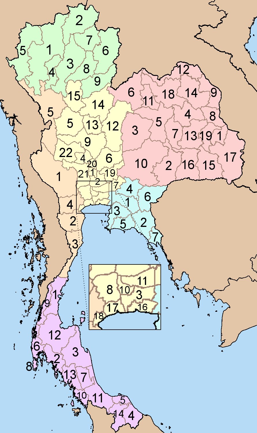
Map of Thailand showing the provinces numbered. Numbering is done according to alphabetic sorting of the standard english transscription of the province name, done for each of the six regions separately.
North
|
North-East
|
|
Central
|
East
South
|
| Descrizione | Map of Thailand showing the provinces numbered. Numbering is done according to alphabetic sorting of the standard english transscription of the province name, done for each of the six regions separately. | ||||||||
| Date | Original image 2004-03-21; This version 2008-04-19 | ||||||||
| Sorgende | Based on Image:BlankMap Thailand.png and Image:Thailand provinces.png | ||||||||
| Autore | Ahoerstemeier, edits by Paul_012 | ||||||||
| Permesse: (Ause stu file n'otra vote) |
Stu file jè licenziate sotte 'a Creatività comune Attribution-Share Alike 1.0 Generic licenze
|
||||||||
| Otre versiune |
Image:Thailand provinces.png, which divides the provinces into five regions |


cunde
Cazze sus 'na date/orarie pe vedè 'u fail a cumme asseva jndr'à quidde timbe.
| Sciurne/Orarie | Thumbnail | Dimenziune | Utende | Commende | |
|---|---|---|---|---|---|
| corrende | 13:43, 19 Abb 2008 | | 892 × 1 500 (153 KB) | Paul 012 | Corrected numbering |
| 21:03, 18 Abb 2008 |  | 268 × 450 (28 KB) | Paul 012 | {{Information |Description=Map of Thailand showing the provinces numbered. Numbering is done according to alphabetic sorting of the standard english transscription of the province name, done for each of the six regions separately. |Source=Based on [[:Imag |
Ause d'u file
sta pàgene apponde a stu fail:
Ause d'u file globale
Le seguende Uicchi ausane stu file:
- Ause sus a ar.wikipedia.org
- Ause sus a bg.wikipedia.org
- Ause sus a bpy.wikipedia.org
- Ause sus a ckb.wikipedia.org
- Ause sus a de.wikipedia.org
- Ause sus a en.wikipedia.org
- Ause sus a fa.wikipedia.org
- Ause sus a gl.wikipedia.org
- Ause sus a hy.wikipedia.org
- Ause sus a id.wikipedia.org
- Ause sus a it.wikipedia.org
- Ause sus a mzn.wikipedia.org
- Ause sus a new.wikipedia.org
- Ause sus a sco.wikipedia.org
- Ause sus a sv.wikipedia.org
- Ause sus a sw.wikipedia.org
- Ause sus a uk.wikipedia.org
- Ause sus a vi.wikipedia.org
- Ause sus a war.wikipedia.org